Photo Scott Hunter
Used with permission
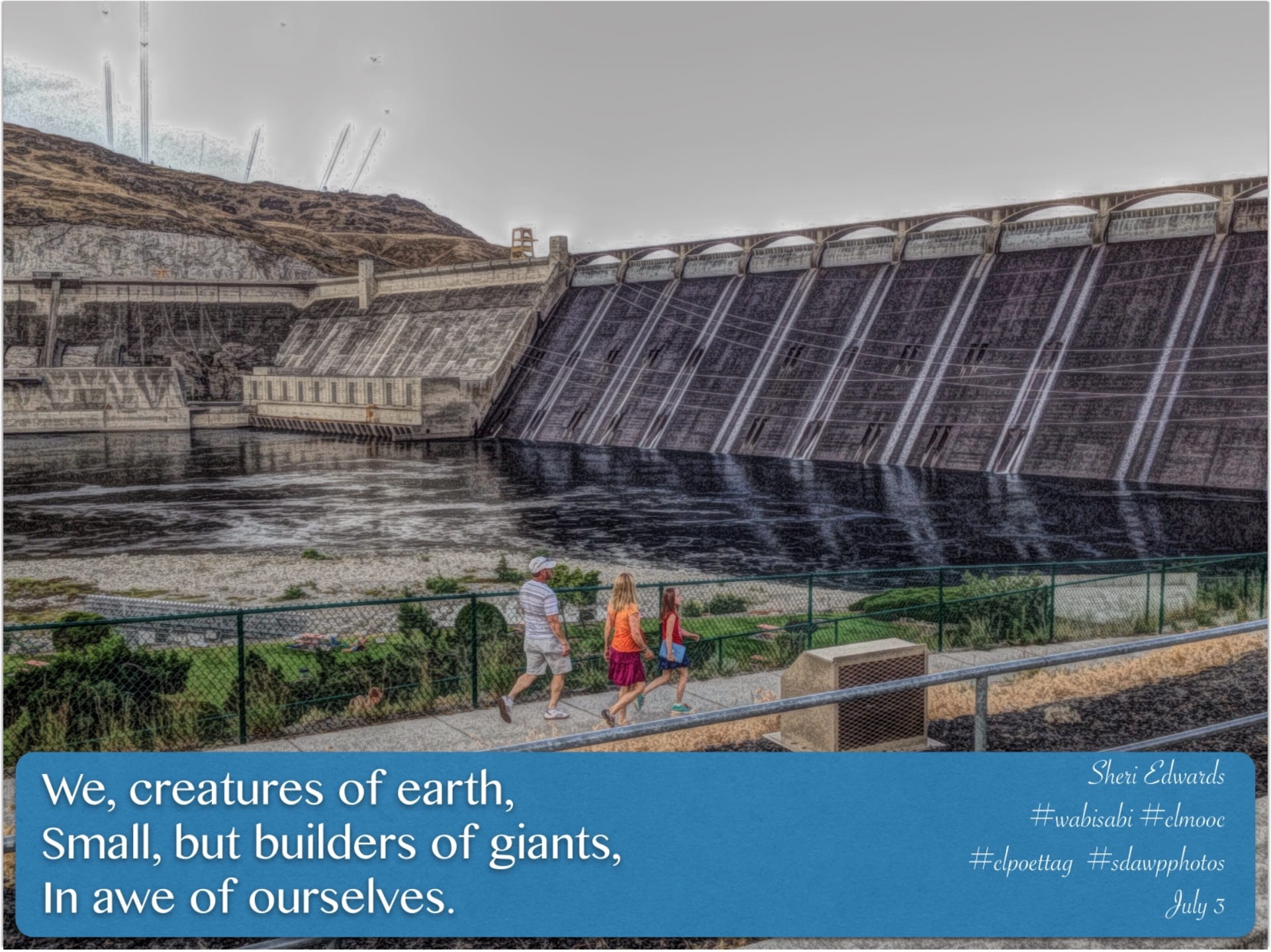
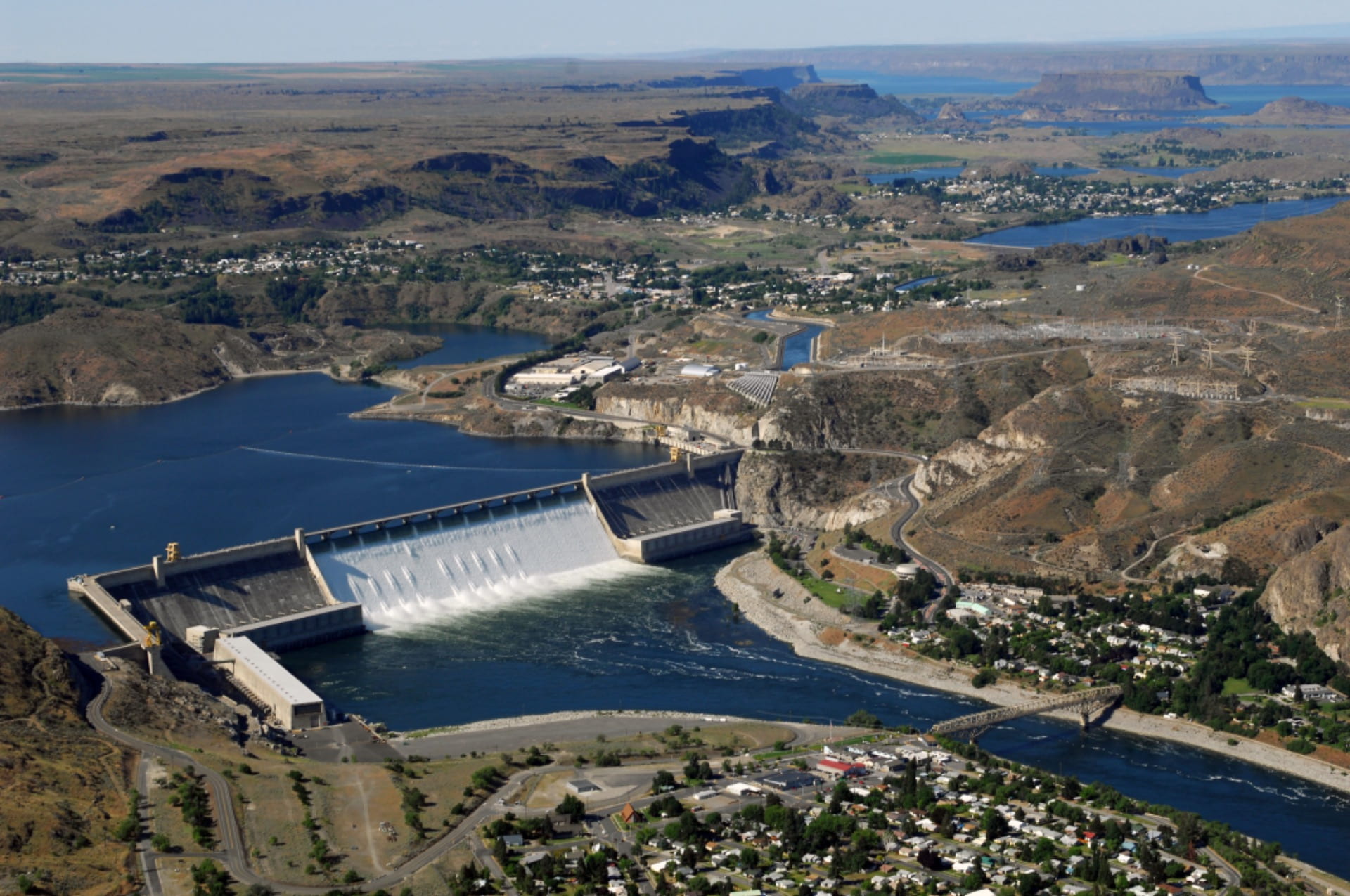
Grand Coulee Dam
In my area of the world sits one of the most amazing structures in the world, the Grand Coulee Dam. It provides seventy-five percent of the power for the Pacific Northwest and put thousands of people to work during the Great Depression. During World War II, it provided the electricity to build the planes and shapes needed to win the war. Amazingly, besides power, it provides the irrigation for an otherwise barren landscape with 330 miles of canals to provide life-giving water to 680,000 acres of land.
This spot was chosen for the geology of the area— notice in the pictures above the natural lower areas for water storing energy created by the walls of basalt lining the area. Below the dam is solid granite. Lots of history— the land and the people are explained in the website for the United States Bureau of Reclamation. Click the link for a great video history.
Lake Roosevelt National Recreation Area
The National Park Service services the reservoir behind Grand Coulee Dam— over 150 miles long— almost to Canada. The Lake Roosevelt National Recreation Area is an amazing park for camping, fishing, water sports, etc., and is so because of the geological history of our area. When I read the Daily Spark and watched the video of Ranger Sam of the Colorado National Monument, I decided to try a little art and gif on my iPad, which you can learn how from Procreate here.
So, take a look— and perhaps try your own, once you see that you don’t need to be perfect!
 Some Tips
To create my gif, I kept it simple. I did my research and took notes:
- Irrigation and Power
Today… - Building of the Grand Coulee Dam
1933 - Ice Age Glaciers and many gigantic floods = erosion
17,000 years ago - Lava flows— many— from a “hot spot”
17 million years ago - Plate Tectonics Subduction Zone = Mountains
200 million years ago - An ocean
250 million years ago
Next, I thought of simple lines and shapes to illustrate each event, creating first the background layer of sky/earth and building in each stage on its own layer in order— just the sketch, no need for the repeat of sky/earth. The animation will set that as “background”
I also created the QR code so people could visit the information at the The Lake Roosevelt National Recreation Area website. In Chrome, select the “share” arrow at top right and choose “Create QR Code.” Then save it to your camera roll.
I saved and duplicated that document. In the duplicated document, I added the text onto each event layer.
My Layers:

Next, I followed the Procreate YouTube video to create the gif. The sky/earth layer is the background. Each layer I chose to “hold” for at least 20-25 frames, with the last QR code frame longer. I played the gif to see if it worked [which is why I new to make the “hold” at 25 frames— long enough to get most of the text]. I then saved and exported my gif. Here’s a replay of the first illustration document and then the add text document:
Be sure to share in the many places!
Places to share here: Writing Project Share Page