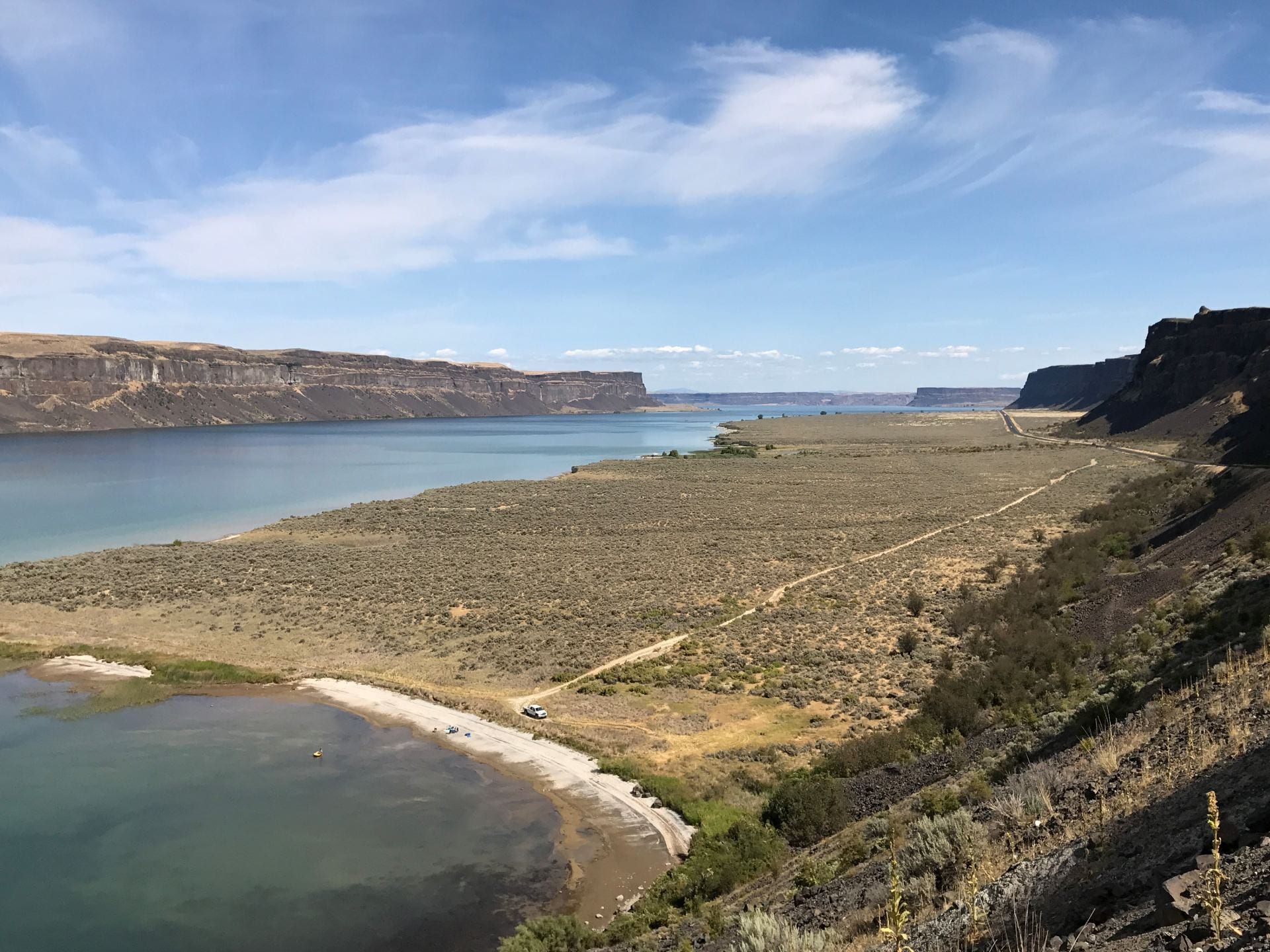
Upper Grand Coulee by Sheri Edwards
Everything has numbers. Parks have numbers. Towns have numbers. Here are a few numbers from the history of the Grand Coulee Area.
Centuries, 1853, 1880, 1894,1899, 1914, 1921, 1933

Information in the above poster is based on this historical sign post, a photo taken in 2001 by student Jordan Leskinen for our class project:
Photo by Jordan Leskinen
In 2001, my students [4h and 8th grade students] created a website called “Signs of the Past,” which was a state-wide student project. The website no longer exists, except through a backup and the Wayback Machine.
Part of their project discussed the Grand Coulee Area, noted in their picture of the sign post, above.
Read some of the students’ information on the Grand Coulee area:
Grand Coulee Area
N 47′ 56.275″ Latitude
W 119′ 00.774″ Longitude
Mileposts 1-21 Highway 155
Inscription
For many centuries Indians have lived along this river. Early Indians and military traffic from Fort Okanogan to Fort Colville and Spokane area passed near here. Lt. Arnold and party camped here while exploring this area in 1853. U.S. Cavalry camped here while traveling old Camp Chelan-Ft. Walla Walla military route from 1879-1880. Grand Coulee Hill Rd. established in 1894 by County Commissioners. Old Seaton Ferry started by Tom Seaton in 1899. Osborne Ferry 1914. Sam Seaton operated Grant County Ferry 1921 at site of Grand Coulee Dam. Construction on Grand Coulee Dam began in 1933. Grand Coulee platted in 1933.
Information
When the Ice Age hit this area, the glacier blocked the main course of the Columbia River. It had to crash a new course, which is through where Banks Lake is today. After the Ice Age, the Columbia River went back to its main course.
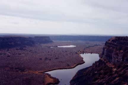
Lower Grand Coulee Photo by Jordan Leskinen
The fish in Banks Lake are bass, trout, perch, blue gill, and crappie. You can even boat at Steamboat Rock as well as water-ski, innertube, and jet ski. The hunting consists of a shotgun and only for birds. For swimming, there are no lifeguards in the area for swimming by the campgrounds. Campgrounds have electricity, showers, picnic ground, and sewage. Hike all over the area by Steamboat, but when winter comes enjoy cross-country skiing.
References:
Amara, Mark S.& Neff, George. E. Geologic Road Trips, Adam East Museum And Art, Center Moses Lake, Washington, 1996
Grand Coulee Dam Area Visitor’s Guide 2001-2002: The Home of Hydropower”, A Supplement to The Star Newspaper
Weis, Paul and Newman, William L. .The Channeled Scablands of Eastern Washington. Eastern Washington University Press,1999
Further Links
Wildernet’s Steamboat Rock Info
I was surprised only two of their links no longer worked. I did find the updated Missoula Flood website from the same original organization. On other parts of their site were these images:

Native Americans were here for centuries. Dry Falls Interpretive Center Diorama; by Jordan Leskinen
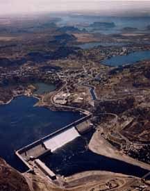
Grand Coulee Dam Picture Click — Bureau of Reclamation
And this blog post excerpt from the student site with their research is a bit of number history also:
Number: Year 2001
Isn’t it fascinating that we can still find the history of the past? And we can share our work and history to remember from where we came.
What’s the history of your area? Share your blog post about it in the comments below.
Photo, art by Sheri, except as noted above.
This post is part of the 2018 Summer #WriteOut in places, parks, poetry, and doodles with #Clmooc. Learn more at CLmooc blog and National Writing Project / National Park Service WriteOut
#campnanowrimo 589
Great exploration of numbers and place ….
Kevin
Hi Kevin, I love the theme of “writeout” about park and place. I’m glad I remembered the student project– it got us out of the classroom and into our community while we learned local history. It was a project developed for the then “new” GIS technology. My–how far we’ve come in tech — in pedagogy, processes, and authentic products! Your students are always right on the edge of authentic learning, and I am so glad that you share it in so many places so others may learn. Thanks for stopping by. ~ Sheri